
HIKING - THE CRIMSON TRAIL AND OTHER UTAH TRAILS
- Jul 16, 2017
- 5 min read
Making a list of hikes in Logan Canyon, and then doing them, was on my Updated Bucket List. I chose to hike the Crimson Trail during my YEAR 77, which is a trail between Spring Hollow and Guinavah Campground in Logan Canyon. Most of the trail follows the China Wall on the south side of the canyon at an elevation ranging from 5,100 feet to 6,000 feet. This exposure gets more water than the north side where the Wind Caves are, so the vegetation tends to be more lush. It also can be very icy until late spring. The trail looks down on Guinavah Campground some 600 feet below.This trail was used as the "Senior Walk" for Brigham Young College's graduating class until the college closed in 1926. The school colors were crimson and gold -- thus the trail's name. It has remained a popular hiking trail ever since that time. Judy and Randy agreed to join me on Sunday, July 16, to do the Crimson Trail hike. We decided to hike from the Spring Hollow trailhead to the Guinavah trailhead, which, according to my Strava app, was 4.2 miles. We returned to Spring Hollow on the Riverside Nature Trail for a round-trip of about 7 miles. We had perfect weather for a canyon hike and I really enjoyed chatting with Judy and Randy as we made our way along the trail - a fun morning experience.
The photo below on the left was taken during a hike I made to the Wind Caves in the summer of 2015. The Wind Caves are directly north across the highway from Crimson Trail and you can see the China Wall across the way which is where the Crimson Trail goes. The photo on the right was taken today on the Crimson Trail hike and looks directly across the canyon from the top of the China Wall to the Wind Caves, visible in the center of the photo.
Click Photo to Enlarge - Use Arrows for Next Photo


The photos below were taken during today's hike - from the left:
1st row: Randy and I on the bridge just before the Crimson Trail sign; Judy & Randy at the Crimson Trail sign; Randy & Judy at a ledge of the China Wall (it was a long ways down!); Randy and I on the China Wall with the Wind Caves visible in the background between us.
2nd row: The trail was steep up at the start, and steep down at the end. All along the trail was quite narrow, and varied from reasonably smooth to quite rocky. First two photos: Judy on a part of the uphill trail that was reasonably clear of rocks; Randy at the top of a downhill portion of the trail that was rocky with many rocks and ledges. Third photo: Randy's shoes were a little small for him and his toes got sore. In this photo it looks like he is hiking uphill, but he is going downhill backwards. This was easier on his feet than going frontwards. Last Photo: Judy & Randy standing at the Riverside Nature Trail sign - the way we returned to Spring Hollow.
Click Photo to Enlarge - Use Arrows for Next Photo


This hike takes a moderate amount of effort, but it is certainly worth it for the view. There was some beautiful scenery and I wish photos did a better job of showing it. Below are some of the scenery photos I took. The photos below from the left:
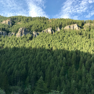
1st row: A view of the mountains along the trail; a view of the highway below and the rock wall on the north side of the canyon; a view of Cache Valley in the distance.
2nd row: Two views of the China Wall from the trail above; Canadian Geese in the river along the Riverside Nature Trail.
Click Photo to Enlarge - Use Arrows for Next Photo


A Little History: Logan Canyon has a wonderful collection of recreational opportunities, including lakes, hiking trails, caves, campgrounds, and breathtaking natural beauty. Even though I grew up in Logan and was a boy scout, there are many hikes and running/biking trails that I didn't experience before moving to California. A couple of years ago I listed those activities I would like to do and began ticking them off.
As a teenager I experienced a scary trip into Logan Cave, which is 12 miles up Logan Canyon and extends about 4,000 feet into the mountain. The cave is extremely narrow in some places and has no large rooms or caverns. The cave is gated now, and I read it was to protect Townsend's Big-Eared bats that live in the cave and are a protected species (I always thought the gate was to keep teenagers out).
As a boy scout I had camped at Tony Grove Lake, which is at an elevation of 8,050 feet, but I had never gone the additional 4.5 miles to White Pine Lake, which goes up over 8,800 feet before reaching the 8,400 feet level of the lake. During the summer of 2015, Amy and her friend Kelly, went on this hike with me. Bonnie and Quent & Barbara met us after the hike at Tony Grove Campground with some drinks and lunch - a great reward for a fun hike. Also during the summer of 2015 I did a solo mountain bike ride along the River Trail from First Dam to the Guinavah Campground, riding the last section on a trail which was marked "foot trail only." Biking that trial was not a good decision. I also hiked to the Wind Caves on a steep, 1.9-mile trail. Millennia of wind and water erosion have created a delicate triple arch and natural cave in the limestone outcropping at the end of this trail. From this site there is a clear view of the China Wall across the canyon, a limestone rock formation that runs along the Crimson Trail.
During the summer of 2016 I walked the Limber Pine Nature Trail at Logan Canyon's 7,800-foot summit and is named for what was once believed to be the oldest and largest living limber pine tree. The trail is just a 1.5-mile loop but has a dozen interpretive signs and beautiful scenery.
During the same summer, Ted & Dixie, Covert and I (in Ted's 4-wheel drive truck), went up Logan Canyon about 15 miles to Temple Fork Road (a very rough dirt road) which leads quite a few miles back to the final resting place of "Old Ephraim," the last and said-to-be largest grizzly bear killed in the region. We also went quite a few miles north of the highway, on a similarly rough dirt road near the Beaver Mountain Ski Area, to the site where a plane had crashed in 1953. All 37 soldiers returning home from the Korean War, and the plane crew of three, were killed in the crash. It was national news when it happened, and I remember hearing about it (I was 13 years old) but I had never hiked back to the scene of the crash. It was a fun and interesting day, capped off by stopping in a campground and having a lunch that Dixie had prepared.
The photos below from left-1st row: White Pine Lake; Amy & I on the hike; the trail to the Wind Caves; and me standing in one of the open caves.
2nd row: The trail-head of Limber Pine Trail; one of the interpretive signs explaining how the limber pines grow so large and close together; Covert, Ted & I at Old Ephriam's burial site; and finally the 1953 plane crash marker.
Click Photo to Enlarge - Use Arrows for Next Photo


Comments