
2019 - JULY SUMMER SCOOTER RIDE
- Jul 28, 2019
- 8 min read

The Annual Summer Scooter Ride took a setback this year (one of many) as the Covert boys (Quent & Jon) decided not to go with us. This left only Dennie and I for the 2019 Ride. The first of these annual rides took place in September 1994 when Merlin and I took a 3-day round-trip ride from Park City to Yellowstone Park. After that first ride, most rides have been five or six days, and we have covered pretty much all of the back roads and beautiful country-side in Montana, Idaho, Wyoming, Utah and Colorado. Although the group has not always been the same, this summer will be the 25th consecutive "annual scooter ride" for me (I have been on many other rides over the years in addition to this ride, such as Route 66, Iron Butt, Death Valley to scout for New Year's Eve, etc). Other participants over the years have been Quent Covert, Duncan King, and Ted Wilson, who together with Merlin and I, made up the five guys that went on the most trips together. Also participating have been Joe Armstrong, Dennie Christensen, Jon Covert, Amy Covert, Jon Fulkerson (in his auto), Dale Hadfield, Carl Malouf, Bob Miller, and Bob Roybal. As of this summer, all have dropped out except Dennie and I. See a few photos from past Summer Scooter Rides at the end of this blog.
Dennie and I decided to take a ride north along the California Coast, and then inland to see the Sequoia and Kings Canyon National Parks. Our schedules reduced us to just a 4-day trip, leaving on Monday, July 22nd. Dennie rode from Riverside to Monrovia on Sunday night and stayed at our place so we could leave together on Monday morning. Weather is always an interesting challenge when riding a motorcycle. This year we didn't experience rain or wind, but a range of heat and chill were ever present. The trip totaled a little over 900 miles from Monrovia, with Dennie adding approximately 90 miles for the Riverside/Monrovia round-trip.
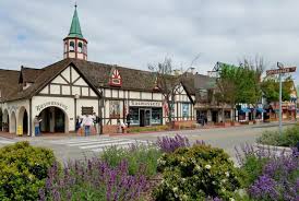
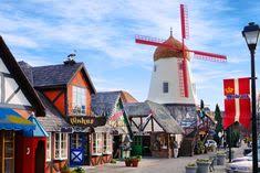
DAY #1 - Monrovia to Morro Bay - We left Monrovia about 7:30 am and rode back streets through Pasadena to I-210 near La Canada to avoid the morning rush-hour traffic in Pasadena. The weather for the full-day ride was very comfortable. The temperature was in the mid-70s when we left and stayed there until we approached the ocean in the Ventura and Santa Barbara area, when it dropped into the mid-60s (light coat time). The ride from Santa Barbara up through the Cachuma Lake Recreation Area to Solvang was beautiful and the temperature moved into the mid-80s. Solvang, located in the Santa Ynez Valley, is a big tourist attraction known for its Danish-style architecture and many wineries. Photos below illustrate some of the main buildings in the village.
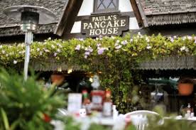
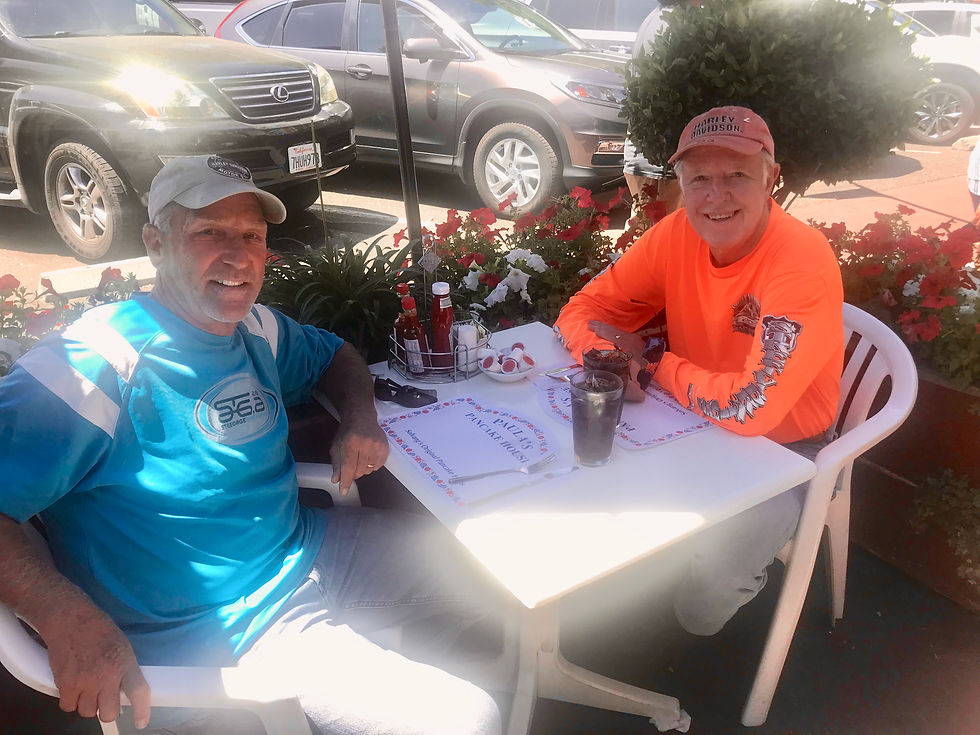
We arrived at Solvang close to noon and stopped at the famous Paula's Pancake House for lunch.
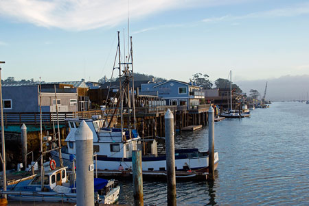
After lunch, and a stroll along the main street of Solvang, we headed west through Buelton, Lompoc, Guadalupe, Pismo Beach, San Luis Obispo and eventually to Morro Bay. The first few towns are nestled in the hills of California's Central Coast, Pismo Beach is known for it's wineries, award-winning board walk, and famous pier. We stopped for the night in Morro Bay, known for miles of unspoiled beaches, lagoons, nature trails and rich saltwater marshes.
After checking into the motel and cleaning up, we walked a little over a mile along the beach to the Embarcadero Area and past the historic Morro Rock, a backdrop for many wedding photos. I took the photo below on the left, but it was so foggy I lifted the one on the right from the Internet to show the entire rock.


We stopped at the Great American Fish Company for a really fine (and large) dinner - it was a good thing it was a mile back to the motel to walk off the dinner.


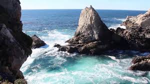
DAY #2 - Morro Bay to Madera - The morning was foggy and cool as we left Morro Bay to meet Dennie's Logan High classmate, Kitty, at Cafe Kevah in Big Sur for a late breakfast. Our route took us on Highway 1 by the small beach communities of Cayucos, Cambria, San Simeon, Ragged Point, Gorda, Lucia, to Big Sur. There was some impressive scenery as we rode up the coast. The first photo below is the Elephant Seal Vista Point, but there were no seals on the beach. This was appreciated because when the beach is crowded the smell is terrible! Many sights, while impressive in person, were too foggy for good photography.


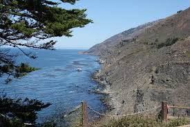
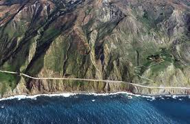
In November of 2017 the "Mother of All Landslides" heaped six million tons of rock and dirt on about a quarter mile section of the coastal highway in the Big Sur region. This section of Highway 1 is now open with a single-lane road amidst a massive road re-construction to restore the two-lane highway for safe travel again. It's unclear when this construction project will be completed. We were stopped by a flagman while south-bound traffic passed the project. With heavy vacation traffic, and this and other construction projects going on, the trip up the coast was slower than normal.
The first photo below is Dennie and I standing on the bridge south of the landslide repair project waiting to proceed north (note the fog in that area). The next two photos (lifted from the Internet) show the highway before and after the landslide.


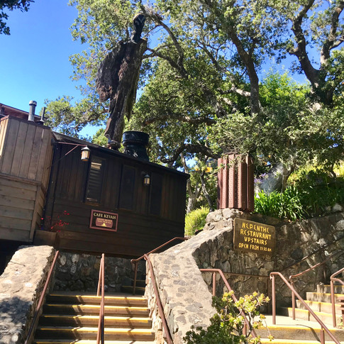
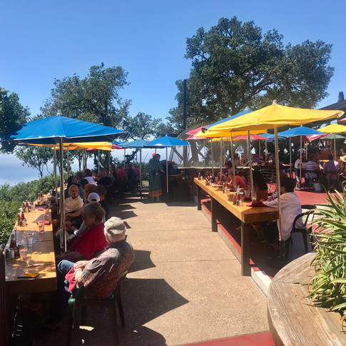
Cafe Kevah is part of a cliff-side complex of Phoenix, a gift shop, Cafe Kevah one level higher, and above everything the Nepenthe Restaurant. The food at Cafe Kevah was wonderful and the atmosphere of Nepenthe looks like it would be a great place to spend an evening. The first photo below shows the stairs up to Cafe Kevah and to the upper level Nepenthe (with the Phoenix gift shop on the left). The second photo is Kitty, Dennie and I having brunch at Cafe Kevah. The second set of photos show the top level Nepenthe and a view from that level, and the last photo is Dennie and I as we were leaving the Cafe parking lot.
Click photo to enlarge. Use arrows to move to next photo


Click photo to enlarge. Use arrows to move to next photo


After brunch we continued north up the coast on Highway 1 through Carmel, Monterey and Castroville, then turned inland on Highway 101 to San Juan Beautista and highways 156/152 east to Highway 99 where we turned south to Madera for the night. After leaving the coast at a comfortable temperature of around the mid-sixties, it got much warmer and was 105 degrees as we pulled into Madera. We cooled down in the swimming pool at the Holiday Inn Express (Dennie took two sessions in the hot tub which makes no sense to me in this weather) and we had a great meal at nearby Sal's Mexican Restaurant.
DAY #3 - Madera to Three Rivers (touring National Parks) - We left Madera around 9 am, rode south to Fresno, then east on Highway 180, which becomes Kings Canyon Highway, into the Sequoia National Forest. We eventually toured both the Kings Canyon National Park and the Sequoia National Park. It was a beautiful day, with temperatures very comfortable until the last hour of the day (it was 105 degrees when we arrived at the hotel - exactly the same temp as yesterday's arrival). Afternoon thunder showers were predicted (70% chance), but they avoided us. We ended the day at Three Rivers, a small community in the foothills of the Sierra Nevada and near the exit from the two national parks.
Kings Canyon National Park is north of and contiguous with Sequoia National Park, and the two are jointly administered by the National Park Service. We showed our Senior Lifetime National Park passes at the gate and proceeded first into Kings Canyon.
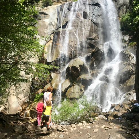
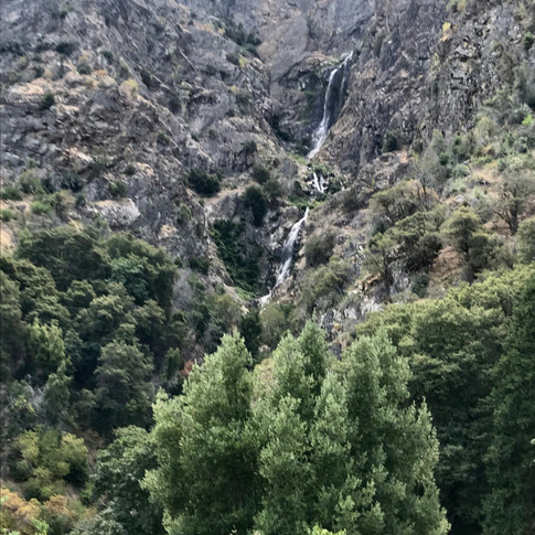
Kings Canyon -This was my first trip to Kings Canyon, so I didn't know what to expect. We rode approximately 30 miles into this rugged glacier-carved valley more than a mile deep. The mountain peaks along the way are as high as 14,000 feet, and much of our trip was along the swift-flowing Kings River. The photos below show some of the scenery along the way.
1st row: Two areas feeding the Kings River, Grizzly Falls and another falls not identified from the road. Roaring River Falls was at the end of Kings Canyon, but required a hike which we elected to pass; 2nd row: Two shots of the Kings River flowing along much of the road back to Cedar Grove Visitors Center (floating/rafting this river would be quite a challenge, but we didn't see anyone trying today); 3rd & 4th rows: A few shots of the rugged terrain in the Canyon.
Click photo to enlarge. Use arrows to move to next photo


We rode to Cedar Grove Visitors Center at the dead-end of Kings Canyon Highway. Although we hadn't seen much traffic on the way down the canyon, as we neared Cedar Grove we began passing many camp sites and I was surprised at the high number of campers at those sites - they clearly numbered in the hundreds. One of the camp grounds was named Sheep Creek and it was marked "Full" as we passed by. A Visitors Center representative told me there were 111 camp sites at that location . All were occupied by families, so obviously there were hundreds of individuals.
Sequoia Park - After Cedar Grove in Kings Canyon, we retraced our ride back to the beginning, then took Highway 198 into Sequoia National Park. Redwoods once grew throughout the Northern Hemisphere. The oldest known redwood fossils date back more than 200 million years to the Jurassic period. Today, the last giant sequoia on Earth live in about 73 groves scattered along the western slopes of the Sierra Nevada. The northernmost sequoia grow in Placer County in Tahoe National Forest, and the southernmost groves live in Giant Sequoia National Monument.
Our ride was within beautiful mountain scenery, on a twisty road through the forest and many huge trees. See the photos below. The last two photos show one location where the north-bound traffic is routed between two large Sequoias.
Click photo to enlarge. Use arrows to move to next photo


DAY #4 - Three Rivers to Monrovia - We had a very pleasant ride home from Three Rivers. The town's name comes from its location near the junction of the North, Middle, and South Forks of the Kaweah River. As we rode out of town on Sierra Dr the picturesque Lake Kaweah was along side for over 10 miles, and for additional miles there were beautiful orchards and many horse properties. As we traveled further south through Porterville there were still many orchards, and as we approached Bakersfield there were a few active oil pumpers out in the orchards. Further along the orchards were gone and there were only oil well pumpers, which didn't make for very interesting scenery (unless you owned some of the pumpers). Even though Southern California was having a heat wave, the ride today was never uncomfortably hot, and as we entered the Los Angeles Basin it cooled down as we passed through some light rain.
It was lunch time when I arrived home in Monrovia and I was treated to one of Bonnie's delicious salads. Dennie texted me later from Riverside and said he had stopped off for lunch at his favorite sushi place before heading home. We agreed it was an interesting and fun trip and we should continue the tradition of the Annual Scooter Ride. Hopefully, some of our prior rider-friends will decide to join us again.
______________________________________________________________________
A Few Past Summer Scooter Rides:
2018: 6-day Tour of Idaho - Photo as we were leaving Logan

2017: 6-day Trip to Rocky Mountain National Park
Click photo to enlarge. Use arrows to move to next photo


2016: 5-day Tour to Montana. Photo in Clancy, MT

2013: 8-day Trip to Sturgis Motorcycle Rally - 1st photo at Mt Rushmore; 2nd in Sturgis
Click photo to enlarge. Use arrows to move to next photo


2011: 7-day Trip to Montana and Glacier National Park - Photos at Lake McDonald Lodge
Click photo to enlarge. Use arrows to move to next photo


2008: 6-day Trip through Southern Utah - 1st Photo at Zion National Park

Click photo to enlarge. Use arrows to move to next photo


2007: 6-day Trip to Montana and Glacier National Park

1994: 3-day Trip to Yellowstone National Park (the beginning) - Photo leaving Park City

Comments